
Category Archives: Laser Scanning
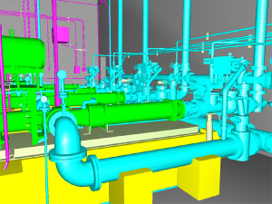
Building Information Modeling – Features and Benefits
BIM, or Building Information Modeling, is a software that helps to generate 3D representations of [...]
Jan
Laser scanning and civil engineering – a partnership we never knew we needed
Civil engineering, as it stands alone, is a broad subject and involves multiple sectors. The [...]
Jan
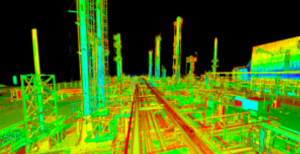
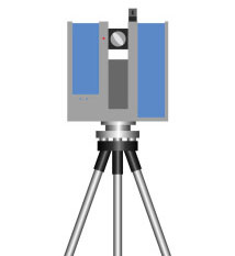
Laser scanning for oil
At McNeil Engineering, we’ve been using LIDAR laser scanning as a tool for civil engineering, [...]
Dec
LIDAR: Precision that saves you time and money
The science and practice of surveying has made a huge advance in recent years due [...]
Nov
Advances in laser scanning
Laser scanning technology is growing fast in the construction industry around the world. By collecting [...]
Sep

Laser scanning tips
Laser scanning can greatly speed up surveying and provide far more information in design documents [...]
Aug

What is laser scanning and how does it help you?
As a tool, laser scanning is finding more and more applications in a wide range [...]
May

A Higher Perspective: How The McNeil Team Uses Drones For ALTA Land Surveying, And More
Did you know? The McNeil Engineering team makes use of a drone in ALTA Land [...]
Sep

Case study: laser scanning at The Psycho Hotel
In the 35 years the McNeil Engineering team has been serving western states communities, we’ve [...]
Jun

Preserving history with laser scanning
Laser scanning technology might sound like something out of a science fiction film, but it’s [...]
Feb