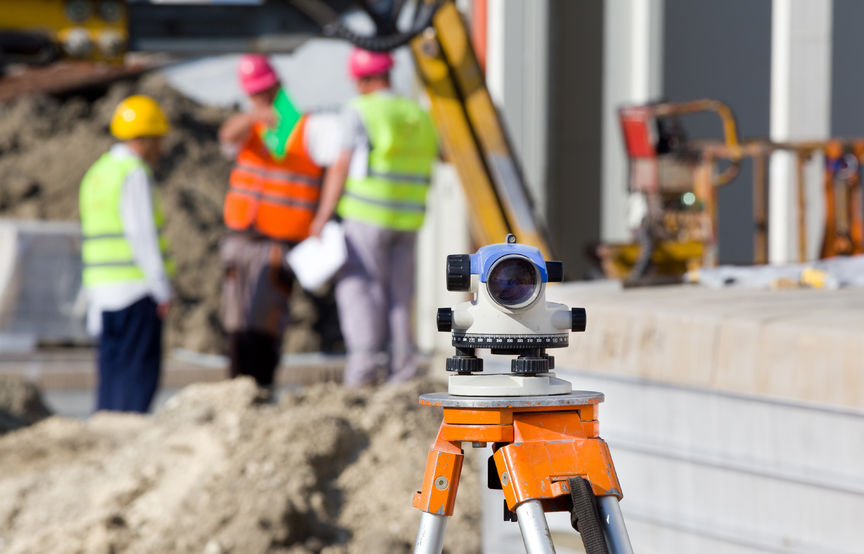
Precision and technology: Exploring modern land surveying techniques
 In the dynamic world of land surveying, precision and accuracy are paramount. As the demands of modern construction, development, and infrastructure projects continue to evolve, so do the techniques employed by land surveyors. In this blog post, we will delve into modern land surveying techniques, highlighting the cutting-edge technologies that have revolutionized the field and continue to shape how we map and understand our surroundings.
The evolution of land surveying: From traditional to high-tech
Land surveying has a rich history dating back centuries when rudimentary tools like chains and compasses were used to measure and delineate land boundaries. While these methods laid the foundation for the profession, the advent of advanced technology has propelled land surveying into an era of unprecedented precision and efficiency.
Global Navigation Satellite Systems (GNSS)
GNSS technology, encompassing GPS, GLONASS, Galileo, and BeiDou, has redefined how land surveyors pinpoint locations. These satellite systems provide real-time positioning accuracy, enabling surveyors to precisely determine coordinates. GNSS receivers accurately calculate distances and positions by connecting with multiple satellites. This leads to the creation of a precise geospatial framework that serves as the backbone for a myriad of applications, from property boundary surveys to large-scale infrastructure projects.
Furthermore, the real-time aspect of GNSS technology amplifies its significance. Surveyors can instantly access positioning data on-site, eliminating the need for post-processing and allowing for informed decisions to be made swiftly. This real-time capability proves invaluable in scenarios requiring time-sensitive adjustments, ultimately streamlining project timelines.
LiDAR(Light Detection and Ranging)
LiDAR technology involves emitting laser pulses and measuring the time it takes for the light to return, creating highly detailed 3D maps. This technique is invaluable for creating digital elevation models, topographic surveys, and even detecting changes in the landscape over time.
The applications of LiDAR are far-reaching, with one of its foremost uses being the creation of digital elevation models. Surveyors can use LiDAR-generated elevation data to produce topographic maps that showcase elevation changes, contours, and terrain features with a level of detail that traditional methods could only dream of achieving. This is particularly valuable in assessing the lay of the land for construction, land development, and environmental management.
Beyond elevation models, LiDAR is a champion in capturing the dynamic nature of the environment. By employing repeat LiDAR scans over time, surveyors can detect even subtle changes in the landscape, ranging from shifts in coastlines due to erosion to vegetation growth patterns. This capability not only aids in informed decision-making but also contributes to our understanding of how the natural world evolves.
Total stations
Total stations combine electronic theodolites and electronic distance meters, allowing surveyors to measure angles and distances accurately. Integrated with data collectors, total stations streamline data collection and reduce manual errors.
UAVs (Unmanned Aerial Vehicles)
Drones equipped with advanced cameras and sensors have revolutionized land surveying. UAVs can quickly capture high-resolution aerial imagery, generate orthomosaics, and create detailed topographic maps for large areas.
GIS (Geographic Information Systems)
GIS integrates geographical data to provide valuable insights. Land surveyors use GIS to analyze and interpret spatial data, aiding in decision-making for land use planning, infrastructure development, and environmental assessment.
3D scanning
3D laser scanning captures detailed images of physical objects and structures, creating accurate digital representations. This technique is essential for capturing intricate architectural details, monitoring structural changes, and facilitating building information modeling (BIM).
Enhancing accuracy, efficiency, and data analysis
Integrating these modern techniques has transformed land surveying into a high-tech science that enhances accuracy and boosts efficiency and data analysis capabilities. Precise measurements and real-time data collection allow surveyors to make informed decisions swiftly, whether for construction layout, property boundary determination, or environmental assessment.
Benefits of modern land surveying techniques
- Time savings: Traditional surveying methods could be time-consuming. Modern techniques expedite data collection and processing, allowing projects to move forward efficiently.
- Accuracy: The pinpoint accuracy of modern techniques reduces the margin of error, resulting in more reliable data for decision-making.
- Safety: UAVs and 3D scanning eliminate the need for surveyors to access hazardous or hard-to-reach areas, enhancing safety on the job.
- Data integration: The data collected through modern techniques can be seamlessly integrated into various software applications, enabling comprehensive analysis and visualization.
- Cost-efficiency: Modern techniques’ enhanced speed and accuracy ultimately lead to cost savings throughout the project lifecycle.
As pioneers in land surveying and engineering, we at McNeil Engineering have embraced these modern techniques to offer clients the highest level of accuracy and expertise. Our team leverages the power of GNSS, LiDAR, drones, and more to provide comprehensive land surveying services that meet the demands of today’s complex projects.
Modern land surveying techniques have not only elevated the precision and accuracy of data collection but have also transformed how we approach construction, development, and land use planning. By harnessing the power of technology, land surveyors can provide accuracy, speed, and reliability. As we continue to embrace these advancements, we enter an era where every data point is a testament to precision, shaping the world around us with unwavering accuracy.
Explore the full spectrum of McNeil Engineering land surveying project samples. Check out these past projects to discover how our modern land surveying techniques and engineering solutions can ensure the success of your next project. We’d love to work with you soon!

