
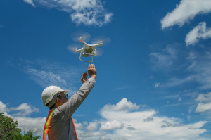
 Drones, also known as unmanned aerial vehicles (UAVs), have revolutionized the field of civil engineering at large, especially with respect to surveys and inspections. With their ability to capture high-resolution images and videos from the air, drones have become a valuable tool for civil engineers to collect accurate data and analyze structures and landscapes. In this blog post, we will discuss the use of drones in civil engineering surveys and inspections and how they are transforming the industry.
Civil engineering surveys are an essential part of the construction process. They involve measuring and analyzing land and structures to determine their topography, elevation, and other critical information required for designing and building infrastructure. Traditionally, civil engineering surveys were conducted using ground-based equipment, such as total stations and GPS receivers. These can be time-consuming and often require significant resources. On the other hand, drones can capture data much more quickly and efficiently, providing engineers with a better understanding of the site and reducing the risk of overall project errors.
One of the most significant advantages of using drones for civil engineering surveys is their ability to capture high-resolution aerial imagery. Drones with high-quality cameras can take detailed site photographs from many angles and elevations. This allows engineers to create three-dimensional models of the area, which can be used to analyze the site and identify potential site or safety issues. For example, if a construction site has a steep slope or is located in a flood-prone area, engineers can use drone imagery to identify potential risks and develop mitigation strategies.
Drones can also be used to conduct structural inspections. Traditional methods of inspecting structures, such as bridges, dams and buildings, can be time-consuming and often require workers to climb to dangerous heights. Drones equipped with cameras and sensors can inspect structures from the air, providing a safer and more efficient way to gather data. Engineers can use this data to detect cracks, corrosion and other defects that may require repairs, allowing them to address issues before they become more significant problems or structural risks.
Besides surveys and inspections, drones can be used for monitoring and surveillance. For example, engineers can use drones to monitor construction sites and ensure workers follow safety protocols. Drones can also monitor infrastructure, such as bridges and highways, for signs of wear and tear. This information can be used to schedule maintenance and repairs, preventing accidents and reducing costs. Win-win!
In addition to their accuracy and precision, drones are highly versatile and can be used in various hazardous civil engineering applications. They can be used to survey and inspect buildings and other infrastructure that might be dangerous like highways or dams. They can also monitor different precarious environmental factors on infrastructure such as erosion, flooding and deforestation. This versatility means that drones can be used in various projects, from small-scale residential construction to large-scale infrastructure development, in many places where it could be dangerous for humans to go.
Another advantage of drones is the speed at which they can collect data. Traditional surveying and inspection methods can take days or even weeks to complete. Drones, on the other hand, can gather data in a matter of hours or even minutes. This means that projects can be completed more quickly, reducing the overall construction time and cost. Efficiency, thanks to technology, benefits our firm and our clients.
Despite the numerous advantages of using drones in civil engineering surveys and inspections, some limitations remain. One of the most significant is their battery life. Most drones have a limited battery life, which can limit their flying time and range. This means that multiple drones may be required to cover larger areas, making a project more time-consuming and expensive.
Another limitation is weather conditions. Drones are sensitive to weather conditions such as wind, rain and snow, affecting their ability to fly and capture data. This means that drone surveys and inspections may have to be rescheduled in adverse weather conditions, which can cause delays and increase costs.
In conclusion, drones have revolutionized the field of civil engineering surveys and inspections. They provide a safer, more efficient, and cost-effective way to gather data and analyze structures and landscapes. Their accuracy, precision, versatility and speed make them an ideal tool for various civil engineering applications. However, the use of drones also comes with some challenges, such as regulatory compliance, data management, battery life and weather conditions. Nevertheless, as drone technology continues to evolve and improve, we expect to see even more innovative uses for drones in civil engineering and other fields.
We hope you’ll contact us here at McNeil Engineering if you ever need a civil engineer (or more!) to help you with a new project. You can also check out some of our previous civil engineering projects here. We look forward to helping bring your project to life!