
Category Archives: Land Surveying

Laser scanning tips
Laser scanning can greatly speed up surveying and provide far more information in design documents [...]
Aug

Drones for engineering
Drones are transforming the architectural, engineering and construction industries. Civil engineering is one of the [...]
Jul

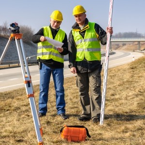
ALTA Land Surveying And When To Call In The Experts
Are you familiar with the term “ALTA land surveying”? Today, we’re providing useful information for [...]
Nov
We’ve performed dozens of ALTA land title surveys
ALTA land title surveys are handled by licensed surveyors like those at McNeil Engineering. In [...]
Nov

A Higher Perspective: How The McNeil Team Uses Drones For ALTA Land Surveying, And More
Did you know? The McNeil Engineering team makes use of a drone in ALTA Land [...]
Sep

Civil Engineering California’s Most Famous Burger Joint
When California’s favorite burger joint, In-N-Out announced that they would be opening a series of [...]
Mar

ALTA land title surveys and laser scanning
As a property owner, title company or commercial developer, you’ve most likely heard of an [...]
Nov

Here’s what our team is doing to help students at City Academy
Over the last few weeks, Mike Hoffman has been out at City Academy, a local [...]
Mar
Surveying at Salt Lake International Airport
If you haven’t already heard, Salt Lake International Airport is undergoing a major transformation. The [...]

McNeil Engineering: Laser scanning and land surveying experts
Getting ready to start a new project? One of the most important aspects of early [...]
Aug