
Category Archives: Land Surveying
What is the future of landscape architecture?
Landscape architecture has been around for centuries; over time, it has evolved to address various [...]
Mar

What does the global 2023 construction outlook reveal?
It’s no secret that 2022 has been a complicated year. The construction sector has seen [...]
Dec

Why is Utah such a great place for business?
We’re proud to be a Utah-based engineering firm. We’ve called his great state our home [...]
Nov

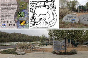
What has McNeil Engineering been up to so far this year? Part I
Welcome to a look at some of our big jobs from the former part of [...]
Jun

A wide range of engineering services
Here at McNeil Engineering, we provide comprehensive design services that include civil engineering, structural engineering, [...]
May

What is the difference between urban planning and urban design?
Here at McNeil Engineering, we are proud of all of our projects that focus on [...]
Apr
A brief history of land surveying tools
Surveying has been an essential service to mankind for all of recorded human history. Before [...]
Feb
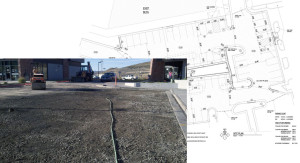
Kimball Plaza parking lot replacement
While we are best known regionally for patented architectural engineering consultation services – which we [...]
Dec

The Future of Land Surveying
Land surveying plays an important role in land development. No wonder it’s been around for [...]
May

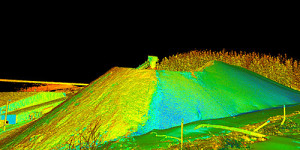
The rising impact of robotics on land surveying
Land surveying is one of the oldest engineering professions, dating back to the Bronze Age [...]
Apr